Example/Applications
Check Natural Frequency
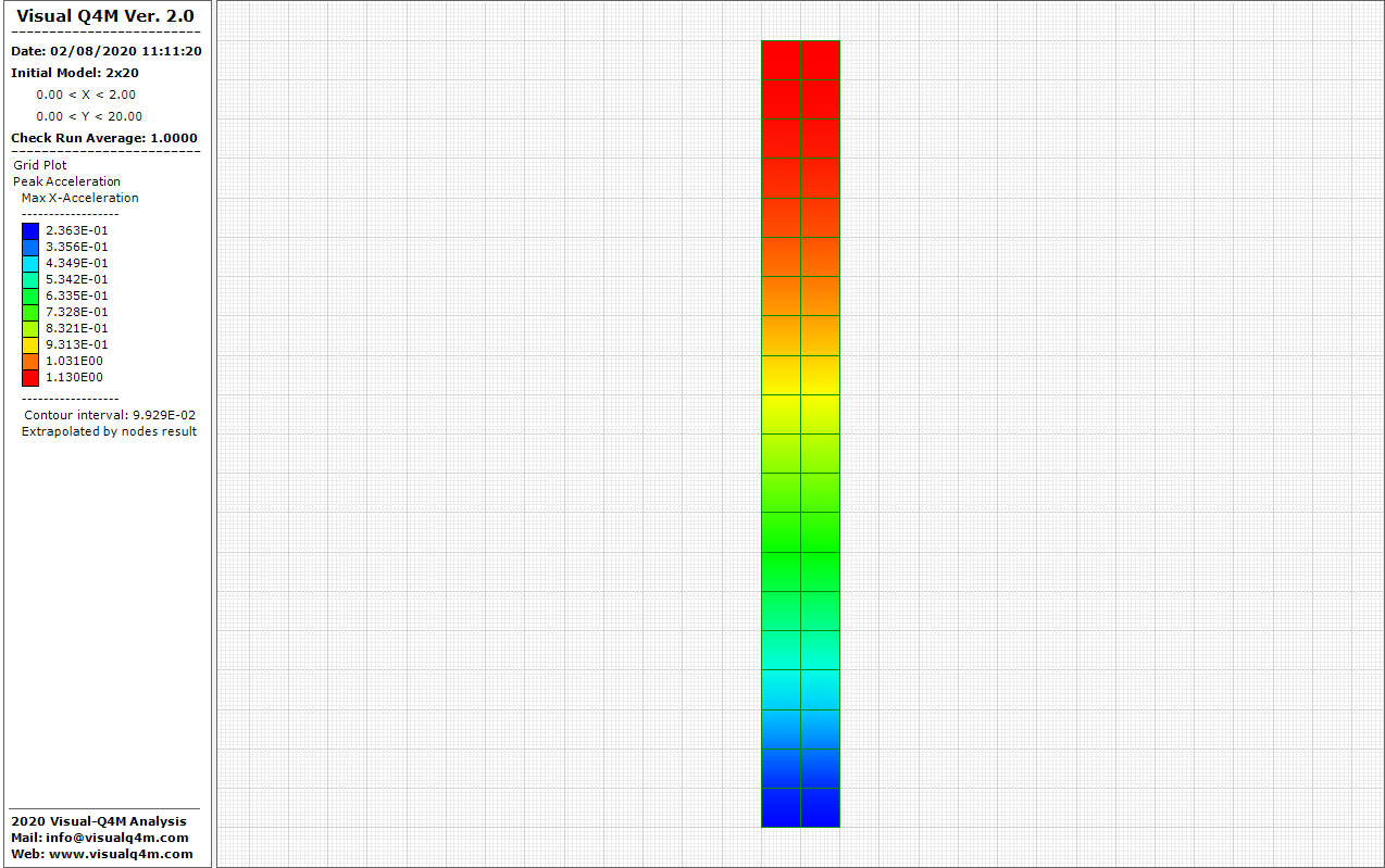
Resonance frequency

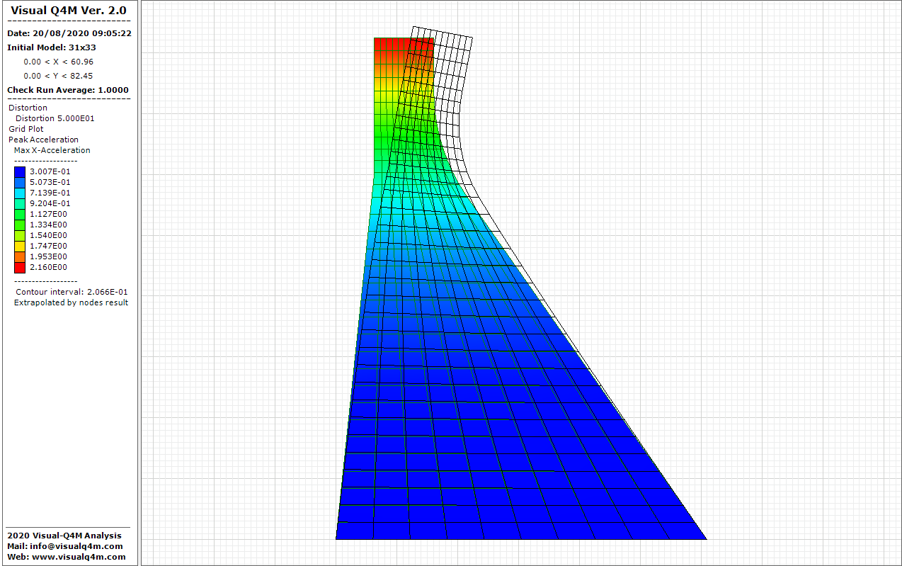
Concrete dam
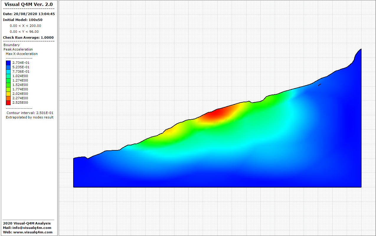
Acceleration peak on the slope
The grid is the work area of numerical analysis and on it are inserted (by zone or groups of zones) the seismic-mechanical properties of soil types. The grid is assembled with elements side by side matching in the nodes (the smallest possible grid that can be analyzed consists of only one zone). The nodes can be modified both in geometry (with arbitrary distortion of the elements) and in input information.
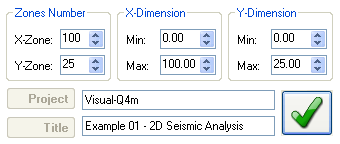
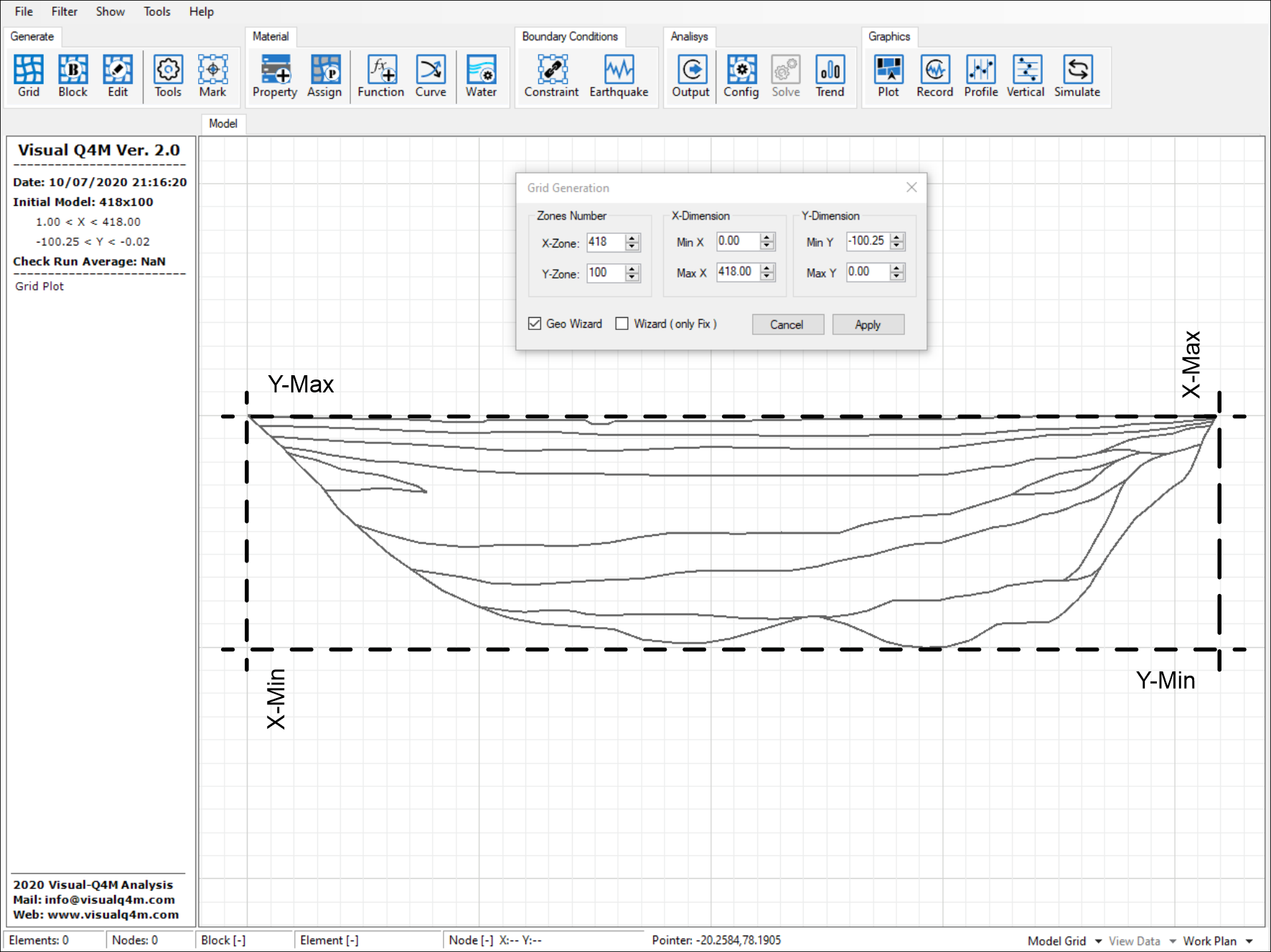
The grid is composed of a number of zones in the direction X and Y and its minimum and maximum size. Importing an Dxf file before generating mesh, the maximum and minimum extension is automatically defined. In this way it's possible to define the physical domain being analyzed and the size of all zones of the model are equal.
Once generated the grid, it is possible to increase or decrease both the number of zones that the number of nodes. Moreover it's possible also change the extension of the grid. The size of the elements is of primary importance in the analysis, the use of excessively coarse elements is a filter of the high frequency components because small wavelengths cannot be adequately modeled. To avoid this, the height of the zones is proportional to the minimum value of the shear waves.
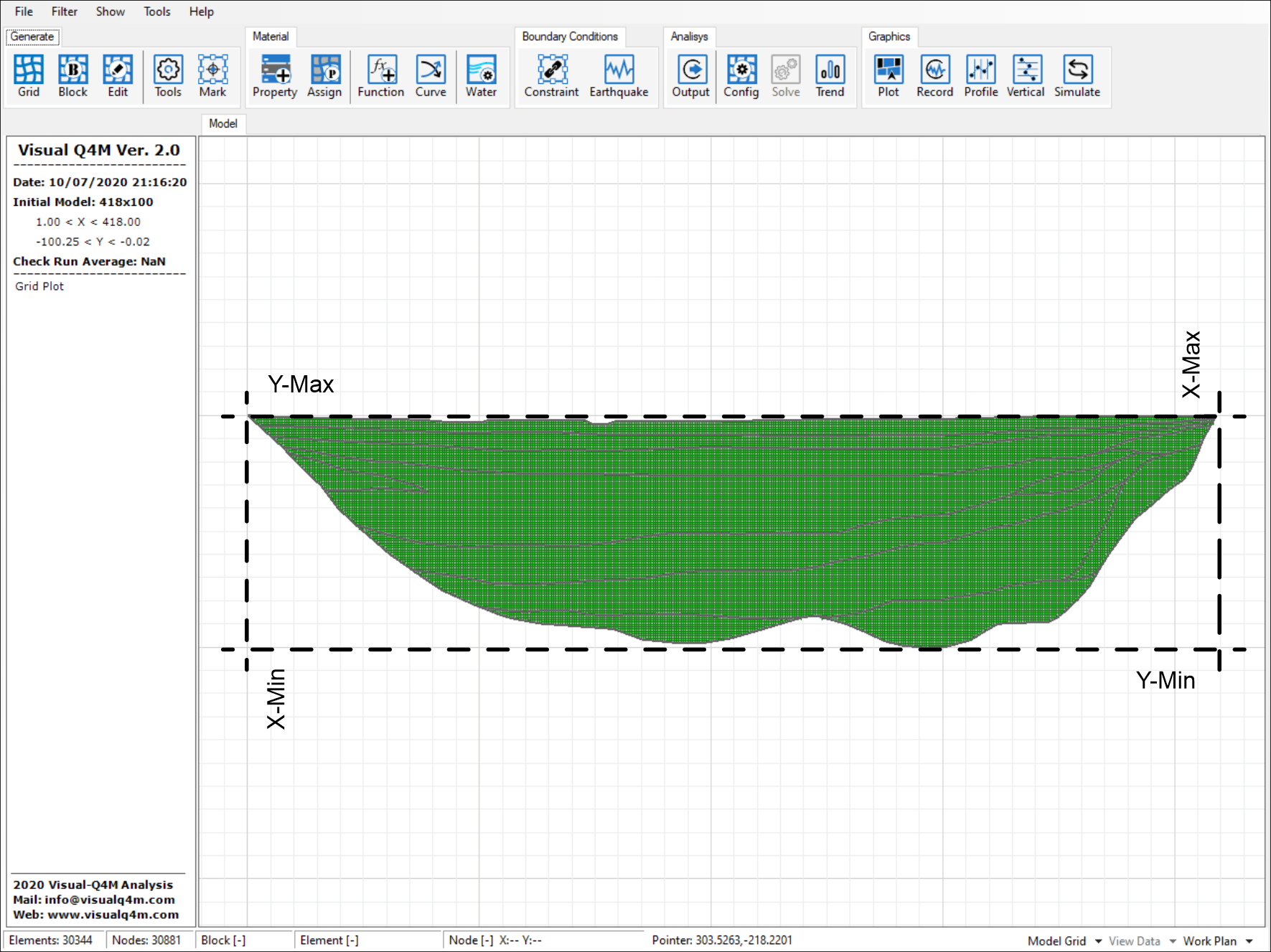
It is appropriate to consider square areas, but for particular situations the relationship between the horizontal and vertical dimension of the element (Aspect Ratio) must not exceed three.
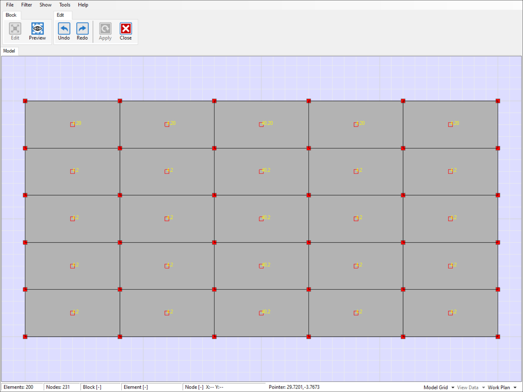
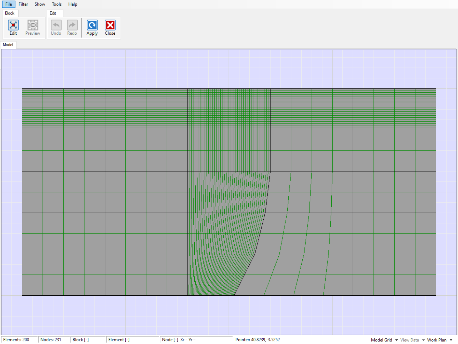
The grid is assembled with grid blocks side by side to form a macro-grid deformable and moldable manually for simulate complex geometries. For each block both geometrical size and number of zones can be modified. Initially must be insert a number of equal zones for all the blocks that is possible modify subsequently.
The position of the vertices or the number of zones of the individual blocks can be changed manually or graphically in order to adapt the grid to the needs of the model to be analyzed. When it's changed the zones number in a block, it's recalculates automatic the continuity of zones in the entire model.
Check Natural Frequency
Resonance frequency
Concrete dam
Acceleration peak on the slope
Copyright © 2025 - All Rights Reserved - visualq4m.com
Template by OS Templates